CIOAdvisor Apac

  • Home
  • Vendors
  • News
  • Conference
  • Whitepapers
  • Newsletter
  • Subscribe
  • About Us
  • Specials

  • Menu
      • Ad Management
      • Application Security Testing
      • Artificial Intelligence
      • BPO
      • Contact Center
      • Data Analytics
      • Deep Learning
      • Digital Marketing
      • Digital Transformation
      • Disaster Recovery Services
      • Disinfection and Sanitization
      • E-Invoicing
      • Ecommerce
      • Govt Tech
      • HubSpot
      • Human Resource
      • ICT
      • IoT
      • Laser and Photonics
      • Leadership Development
      • Logistics
      • Machine Learning
      • Marketing Technology
      • Mobile Application
      • Parking Management
      • Payment And Card
      • SDN
      • Telecom
  • Digital Transformation
  • Logistics
  • IoT
  • Payment And Card
  • Artificial Intelligence
Specials
  • Specials

  • Ad Management
  • Application Security Testing
  • Artificial Intelligence
  • BPO
  • Contact Center
  • Data Analytics
  • Deep Learning
  • Digital Marketing
  • Digital Transformation
  • Disaster Recovery Services
  • Disinfection and Sanitization
  • E-Invoicing
  • Ecommerce
  • Govt Tech
  • HubSpot
  • Human Resource
  • ICT
  • IoT
  • Laser and Photonics
  • Leadership Development
  • Logistics
  • Machine Learning
  • Marketing Technology
  • Mobile Application
  • Parking Management
  • Payment And Card
  • SDN
  • Telecom
×
#

CIO Advisor APAC Weekly Brief

Be first to read the latest tech news, Industry Leader's Insights, and CIO interviews of medium and large enterprises exclusively from CIO Advisor APAC

Subscribe

loading
  • Home
  • GIS
  • Ranking

THANK YOU FOR SUBSCRIBING

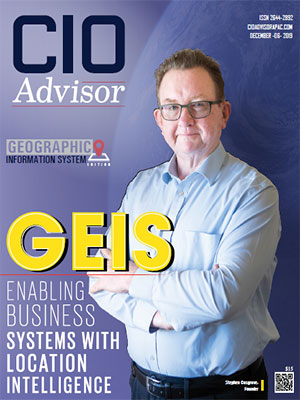
  • GEIS: Enabling Busines Systems With Location Intelligence
  • Top 10 GIS Consulting/Service companies in APAC - 2019

    Technical advancements and newfound capabilities of Geographic Information Systems (GIS) manifest themselves in the way we use maps, and how we apply it to problem-solving. Today, GIS technology is being utilized in several business and management operations in telecommunications, railroads, civil engineering, petroleum exploration, cities, state government, utilities, retailing, and in many other private and public sectors.

    Building information modelling (BIM), augmented reality, and virtual reality is becoming crucial for digital construction revolution. However, reality modelling and BIM cannot reach their full potential without intelligent GIS databases. Together, BIM and GIS provide the users with a clear picture of a project and more spatial awareness about the project design and construction life cycle.

    For successful GIS implementation, there are a few players in the market with proven strategies that offer consulting services to support the complete project life cycle, incorporate project design and planning, GIS orientation seminars and workshops, user needs assessment, requirements analysis, cost analysis, solution design, project management, development, testing, and deployment.

    In the wake of the rising importance of GIS, choosing the right GIS consulting service becomes crucial. This edition of CIO Advisor APAC features companies like GEIS that is at the forefront of offering GIS services. CIO Advisor APAC’s editorial board has assessed and shortlisted some of the most prominent organizations in the industry. We present to you – “10 Most Promising GIS Consulting/ Service Companies – 2019”.

  • TOP VENDORS
    Top 10 GIS Consulting/Service companies in APAC - 2019

Nominate a Company

Our subscribers nominate the companies with whom they have collaborated and gotten results. If you think there is a company that deserves to be on our upcoming prestigious annual list of Top 10 GIS Consulting/Service companies in APAC , please write to us about them and the reasons you think they need to be on the list

* 

Thank You!

checkmark

Your nomination request for upcoming annual list of "Top 10 GIS Consulting/Service companies in APAC " has been Successfully Sent . We will be in touch with you shortly.

Data not inserted

    Top GIS Consulting/Service companies in APAC

  • GEIS

    GEIS

    Provides geospatial technology integration and consultancy services by adopting continuous methodologies enforcing standard pipeline and delivery practices in GIS

    geis.com.au

  • Antaragrafik

    Antaragrafik

    Established in 1995, Antaragrafik Systems is a technology solution provider and system integrator in Malaysia within the Geospatial Industry. The company focuses on geospatial, airborne surveying, mapping, and utility industry. The company offers complete and comprehensive solutions with value-added expertise and specialized in leading-edge information technology solutions, which encompasses the business process and IT infrastructure. The company provides best suits according to the client’s unique needs and priorities. The company also delivers knowledge management processes for a reliable reference base and allows the clients to build a strong foundation for their businesses

  • CyberSoft

    CyberSoft

    CyberSoft Integrated Geoinformatics. Inc offers maps, location-based applications, Geographic Information System (GIS) application, and GPS navigation and tracking systems. The company delivers GIS consultancy and field survey services to the clients. The company aims to develop advanced maps and map-based applications according to its clients' demands. The company carries expertise in GIS technology and in-depth data, and provide value-added, integrated data and applications for the clients’ business planning and decision-making. The company commits to long-term sustainable advantages to its business partners while developing and nurturing innovative and creative technologies. The company focuses on enhancing its service and application value for contributing to society

  • Geo Sense

    Geo Sense

    Geo Sense Sdn. Bhd. offers a premium service in delivering high-resolution aerial images on demand. The company encourages the utilization of a glider-based mini Unmanned Aerial Vehicle (UAV). The company’s GPS-guided mini UAV files below the clouds and efficiently capture precision aerial images for land monitoring, remote sensing, and mapping. The company focuses on developing an integrated UAV system for the mapping industry. The developed UAV by Geo Sense is light weighted and glider based with an autonomous GPS-guided system and onboard camera. The highly-integrated UAV offered by the company fly at a certain altitude and air speed, while shooting vertical precision images at predetermined waypoint intervals

  • Geoplex

    Geoplex

    Geoplex specialization in mapping and Geographic Information Systems (GIS), which helps its clients to visualizes data, drive competitive advantages, and solve business problems. The company aims to unlock the power of data by uncovering, classifying, and analyzing large amounts of information to create powerful, high-quality data sets. The company not only maps the collected data context but identifies the opportunity to present an engaging and valuable business case. The company offers expertise in spatial analysis and help the clients through its compelling data narration, which are both relevant to the clients’ businesses

  • Hexagon

    Hexagon

    Hexagon, a sensor, software, and autonomous solutions provider, focus on boosting efficiency, productivity, and quality across industrial, manufacturing, infrastructure, safety, and mobility applications. The company develops technologies that contribute to shaping urban and production ecosystems and become increasingly connected and autonomous. The company ensures a scalable, sustainable future for its clients to discover. The company creates solutions that visualize location intelligence and bridge the gaps between the geospatial and operational worlds. Hexagon commits to utilizing the data to empower and autonomous future. The company provides real-time location intelligence solutions by using Application Programming Interfaces (APIs)

  • Kokusai Kogyo

    Kokusai Kogyo

    Kokusai Kogyo Co. Ltd. provides advanced solutions that merge the geographical and urban planning technologies for utilizing disaster prevention and disaster risk reduction expertise. The company contributes to rebuild Japan’s social infrastructure with renewable energy sources and create safer, disaster-resistant communities for the future. The company provides engineering consulting services based on geospatial information technology expertise by combining cutting-edge geospatial information technology with various government services. The company strives to develop innovative products and services for flexibly capturing consumer trends and significant public sector related to issues. The company emphasis on environmental and renewable energy businesses to strengthen strategic growth

  • PT Integrasia Utama

    PT Integrasia Utama

    PT Integrasia Utama is an Indonesian firm offering remote sensing & digital mapping solutions and services. With the end-to-end services, the company looks to cater to customer demands comprehensively. PT Integrasia Utama provides data acquisition, data processing, and data analysis capabilities. The data acquisition method employed by the service providers helps acquire information inputs from satellites, aircraft, and UAVs to develop maps. The accuracy with which PT Integrasia Utama formulates its maps is commendable. Besides, the Integrated GPS Geodetic enables real-time control and monitoring of data collection in the field

  • PT Waindo SpecTerra

    PT Waindo SpecTerra

    PT Waindo SpecTerra offers a host of digital mapping and GIS services. The company’s services also include a Thematic Mapping, GIS Analysis, hydrographic, and terrestrial surveys, among others. Using aerial photo technology, LIDAR, and UAVs, PT Waindo SpecTerra achieves its digital mapping capabilities. The company also utilizes satellite imagery to develop digital maps. The GPS and 3D mobile systems come in handy while conducting surveys. Besides, the company also offers data and software to its customers. The digital capabilities that the company possesses can add a lot of value to its offerings

  • TalMap

    TalMap

    TalMap is a company that offers an ActiveX based Map Component, which leverages Korea's largest database. TalMap is crafted so that it can be implemented across geographic information system-based applications. With the company's capability, GIS applications can solve cost and time problems at once. Several GIS application providers are already using TalMap to enhance the functionalities of their services. A large number of objects can be conveniently displayed without affecting the speed or display quality due to Oriented Component. Several UI components can also be added to applications that use TalMap

I agree We use cookies on this website to enhance your user experience. By clicking any link on this page you are giving your consent for us to set cookies. More info

Copyright © 2025 CIO Advisorapac. All rights reserved. Registration on or use of this site constitutes acceptance of our Terms of Use and Privacy Policy |  Sitemap

follow on linkedinfollow on twitter
This content is copyright protected

However, if you would like to share the information in this article, you may use the link below:

https://gis.cioadvisorapac.com/vendors/top-gis-consulting-service-companies-in-apac.html